About Dzongkhag


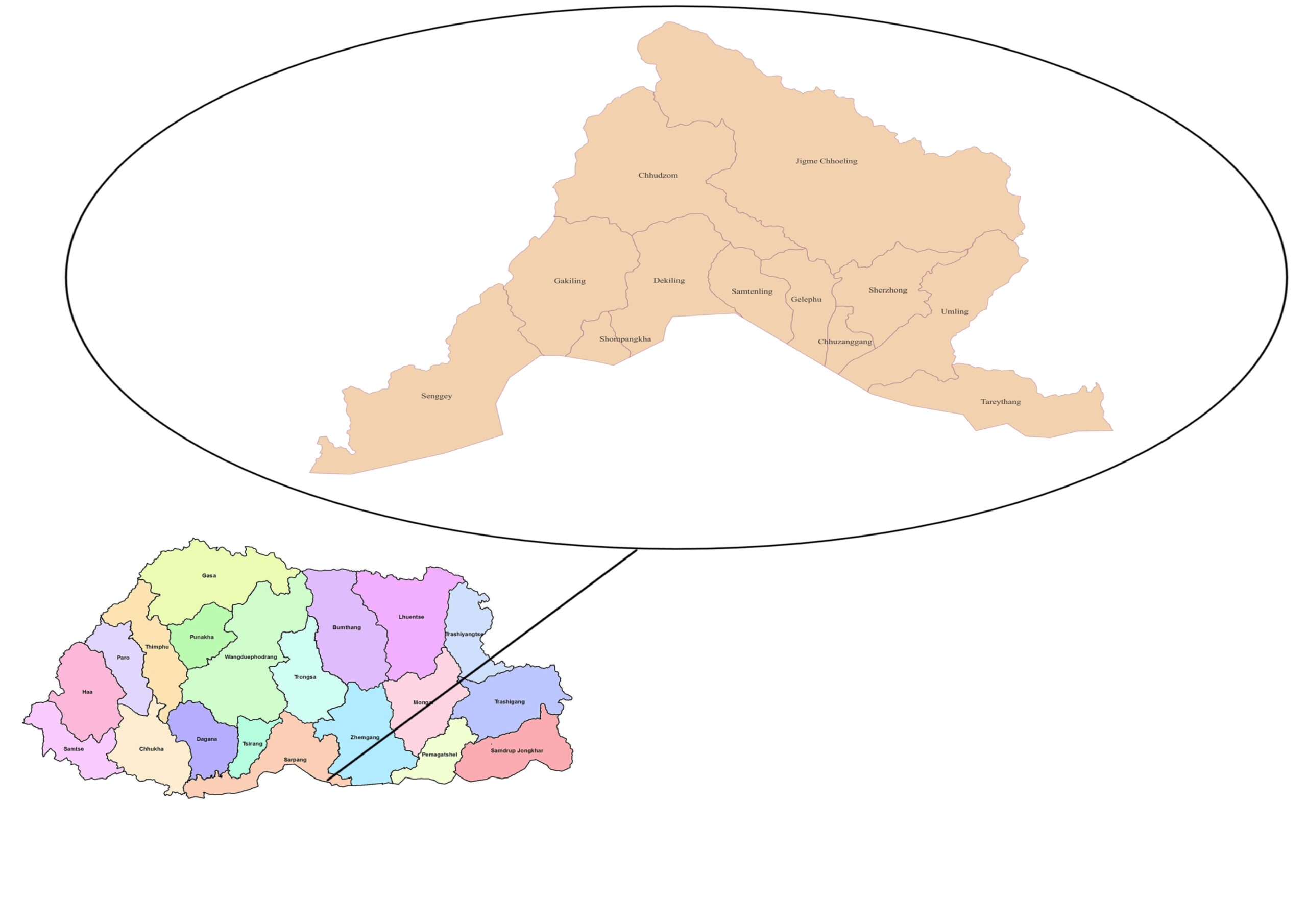
Geographical location of Sarpang Dzongkhag

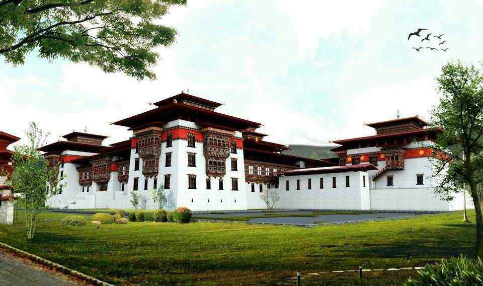
dzong


HISTORICAL BACKGROUND OF SARPANG DZONGKHAG

Background

With an area of 1655 sq.km, Sarpang Dzongkhag is located in the south central part of Bhutan with an elevation ranging from 200 meters to 3600 meters above the sea level. It shares  a  border with Assam state of India in direct contact with Kokrajhar and Chirang districts.  Internally, it shares border with Zhemgang in the east, Tsirang in the west and Trongsa to the north. The Dzongkhag's population of 48,095 (of which 49.54% are female) people from 10,388 households are spread across 12 Gewog (blocks), 61 Chiwogs (sub-blocks) and a Thromde (Municipal Administration). The population concentration is more in Gelephu Thromde followed by Gelephu and Dekililng Gewogs. The least populated is the Tareythang Gewog with only 1024 people. 

Sarpang takes pride in being very rich in biodiversity. With 88% of its land under forest cover, Sarpang is host to Royal Manas Park and Phibsoo Wildlife Sanctuary which provide natural habitat to numerous species of animals, birds, fishes and reptiles – some of which are globally endangered.  While elephants, golden langur, gaur, spotted deer, wild buffaloes, hornbill, hare, etc are sighted most frequently – often coming in conflict with them - the two protected areas are also homes to Royal Bengal tiger which is one of the globally endangered animal species.

Sarpang too serves as one of the gateways to Bhutan from India. With integrated check posts at Gelephu and Shompangkha, it is the commercial center for central Bhutan.  

Brief History as an Administrative Center

The history reveals that Sarpang region was administratively under Paro Penlop until the institution of Chichap (regional governorship) system in 1955. The system of governance then was directly from the central.  The institution of Lhotsam Chichab in 1955 and establishment of the Chichab Office in Shompangkha area was the biggest ever milestone in the history of the governance system as it brought the administration closer to the people. Later the Chichab system was reformed and Sarpang was created as Dzongkhag (district) with the appointment of/alteration of the term Chichab to Dzongdag in 1973.

In 1975, the District Administration was shifted to Gelephu where the old Dungkhag Office now stands. However, the people of Shompangkha submitted for a relook into the decision of shifting the offices of the Dzongkhag administration.  Hence, the Dzongkhag Administration was brought back to Shompangkha and the Dungkhag (sub-district) administration was created in Gelephu. In order to reach the service at the people’s door step, the Dungkhag administration was shifted to Umling in 2019.

Behind the Name: The Meaning and History of Sarpang

Neither the paying of taxes to Paro Penlop nor the institution of Lotsham Chichab is the beginning of the history for Sarpang. Sarpang infact takes pride as the starting point of the history of the advent of Tantrayana Buddhism in Bhutan that is associated with Guru Rinpoche. The term Shompangkha which can be loosely translated as “leaves over the meadows,” dates back to the time when Guru Rinpohce entered into Bhutan enroute to Bumthang in 746 AD to mediate between Sindhu Raja and Naoche who were then a warring factions. The area where Pelri Sangchen Yoeselchoeling Zangdokpelri now stands is said to be the site from where the name of the place as “Shompangkha” emerged. It is narrated that the people of the area made a cushion with leaves on a meadow where Guru Rinpoche was made to sit and served tea during his entry. His Holiness Dudjom Jigdrel Yeshey Dorji (1904-1987) who possessed clairvoyance to see through past, present and future lives is said to have confirmed the story behind the derivation of the nomenclature.

Similarly, the place name Sheychamthang (previously called Ranibagan) is said to have derived from the entry of Sindhu Raja and his wife who were exiled to Bhutan after his defeat in war with Naoche. Shecham is an honorific Bhutanese term for wife of a king or a religious figure of high importance. Sheychamthang means the land of the wife of the Sindhu Raja and they were said to have rested at the currently location of the town enroute to Bumthang. Naoche and Sindhu Raja were both Kings of separate kingdoms in India. Sindhu Raja settled in Bumthang after being exiled after his defeat in war with Naoche. His animosity with Naoche continued thereby requiring the tantric master Guru Rinpoche to mediate between these warring factions.

Though it is unclear as to when the Dzongkhag was named Sarpang and why it was decided to adopt that name, it too has a background story as to how the name was derived. The Department of Culture states Sarpang as a combination of two Sanskrit words – “Sar” and “Bang.” Sar is interpreted as a person in meditation and Bang as disturbed. As the Sarpang comparatively has temperate climatic conditions than the Indian plains, a religious Indian was said to have meditated at a cave called Duvar, but he was disturbed by the negative forces thereby giving forth the term Sarbang. Later the term deteriorated to Sarpang.

People that there could be numerous sacred places – both religious and historical - given that there is sufficient evidence that Guru Rinpoche and Sindhu Raja had travelled through Sarpang.

Strengths and Potentials

The virtue of being located at the border and having 88% of the land under forest cover gives Sarpang more advantages than other Dzongkhags in the country. Hence the potentials are multi-faceted some of which are as specified below:

  1. Beautiful landscape and its fertility: Sarpang has the most favorable land area in terms of its natural landscape and soil fertility. Most areas are plain where all kinds of crops can be grown and mechanization possible. From the upper stretches of the land can one see a panoramic view of the plains both Bhutan and across the border. Autumn is the season where one can see the land filled with colors of golden paddy fields.
  2. Socio-Cultural Diversity: Sarpang is one of the districts that presents multi-ethnic and cultural diversity to the country. So has it the linguistic diversity. People showcases their own ethnic norms, religious values and celebrations. However, they are united when it comes to the needs of their own community.
  3. Easy access to markets: The proximate location of the Dzongkhag to India gives advantages to people from all walks of life. People can buy construction and farming equipment machineries and tools at cheaper prices. Even the labour is inexpensive. Further, as the Gelephu is the major commercial center where people from central parts of Bhutan gather for trade and commerce, most of the agricultural and livestock produces are easily traded. Gelephu infact has been the commercial center as well as gateway to Bhutan till now.
  4. Bountiful River Bed Material (RBM) Resources: As the Dzongkhag is located at the foothills, the RBM resources are richly available for construction activities both within and outside. Infact, these resources are exported to RBM-deficient country like Bangladesh and neighboring Assam state of India.  
  5. Rich Biodiversity: The fact that 88% of the area under forest cover presents us with rich biodiversity. The two protected areas – namely Royal Manas National Park in the east and Phibsoo Wildlife Sanctuary in the west – is a natural habitat for various species of animals, birds, insects and plants. Even the endangered species like Royal Bengal Tiger and golden langur can be viewed in these parks. Spotted deer, peacock, elephant, gaur and a varied species of other animals add beauty to the forests at all times.

This Dzongkhag could therefore leverage above strengths and opportunities for faster socio-economic growth. Farm mechanization to enhance efficiency in production, promotion of ecotourism and creating enabling environment for trade and commerce could be adopted as the main strategies for socioeconomic development.

Challenges

As much as the Dzongkhag is advantageous being located at foothills and border with India, we have challenges confronting us in many aspects.

  1. Longer monsoon and floods: The monsoon season starts as early as May and lasts till September. Unlike in the other regions, rainfall is heavy that causes streams and rivers to swell bringing destruction to land, infrastructures and other facilities. Most often, transport and communication would be disrupted and crops battered to ground.
  2. Human wildlife conflict: Human wildlife conflict are often reported. Just as crop depredation is an annual ritual by wild animals like wild boars, deer, porcupine, birds, etc, we would atleast have one or two cases of human beings being killed by elephants.
  3. Frequent outbreak of zoonotic diseases: Sarpang is also one of the districts that makes headline in outbreak of rabies and malaria. Our efforts to vaccination against rabies and malaria control program would be rendered futile because of the porous borders with Indian state of Assam from where rabid dogs could enter and spread it again.
  4. Competitive prices for goods from across the border: Prices of goods – be it agricultural and livestock products, clothing and utensils – are comparatively cheaper at the border towns. Hence, business entities and farmers make a cry from inability to sell their goods from the shops in Bhutan.  
  5. Water shortages: While Sarpang is a land of numerous rivers in monsoon season, it faces water scarcity in peak winter. Water scarcity is bound to increase as the current sources are drying due to climate change impacts. Interestingly, none of the major river systems in Bhutan touches Sarpang region giving us a great concern for our future.